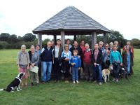
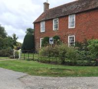
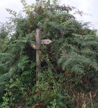
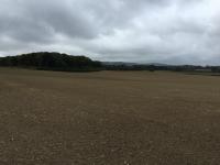
| 10.09 - Group photo photo at
Hollycroft Field before splitting up to follow 2 different routes. |
..... |
 |
|
..... |
|
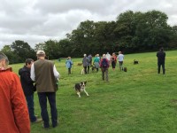
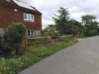
| 10.25 - Setting off (North East a
bit) towards Novington Lane. |
|
 |
|
..... |
|
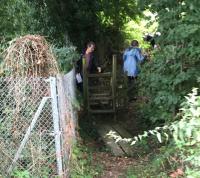
| 10.33 - Having turned left at
Novington Lane (that's away from the Downs) and then (100 yards or so later)
up Pinchers Hill - we turn right to the footpath which runs alongside the
railway embankment. |
|
 |
|
..... |
|
| 10.35 - Looking backwards from the
direction in which we're walking at the the top of the slope we just clambered
up. The railway line is to our right. The Downs (not visible at this camera
angle) are on the left. The power lines you can see are running alongside
Novington Lane. |
|
 |
|
..... |
|
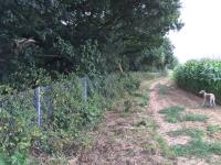
| 10.35 - Someone's dog has waited for
me while I take these photos. It seems to be saying - this is the way we're
supposed to be going. Hurry up and let's rejoin the others. On the immediate
left is the railway line. That's the wire fence. Over the other side of the
railway line (but with fields in between) is Highbridge Lane. |
|
 |
|
..... |
|
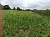
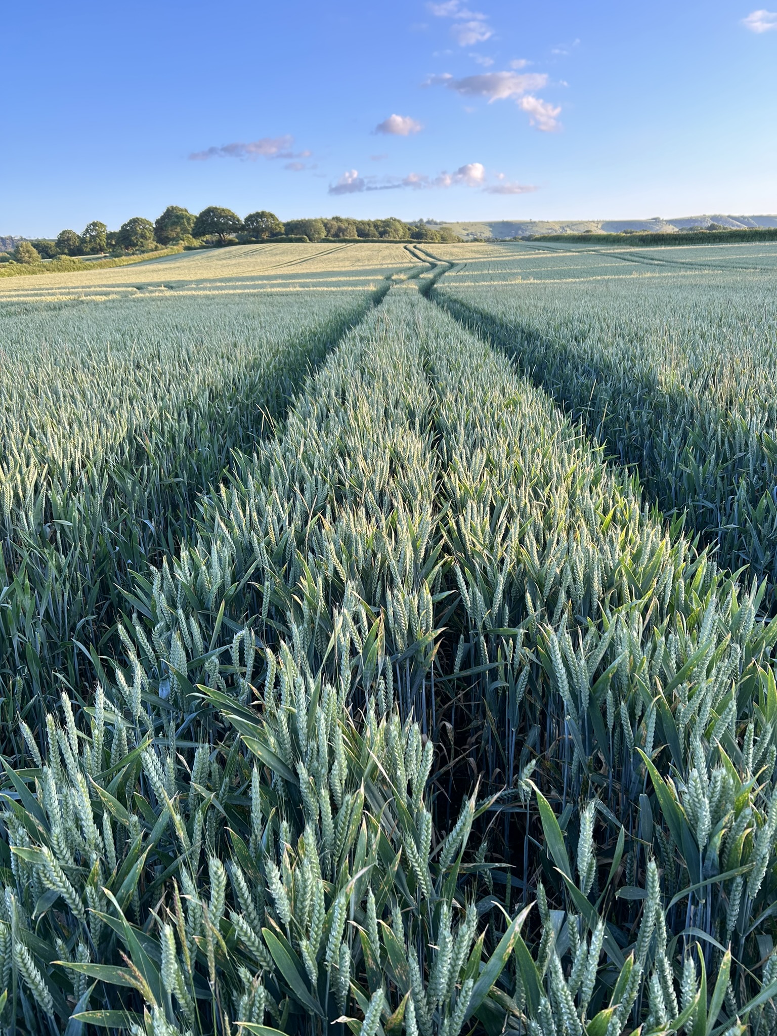
| 10.40 - View of the Downs through a
field of wild flowers as seen from alongside the railway footpath about 7
minutes slow walking distance from Novington Lane while heading in the
direction towards Cooksbridge and Lewes. (But we haven't reached Chiltington
Lane yet.) |
|
 |
|
..... |
|
| 10.44 - look at the sky - that's what
the forecasters were warning about. |
|
 |
|
..... |
|
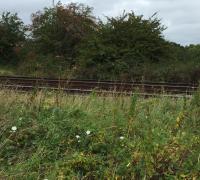
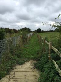
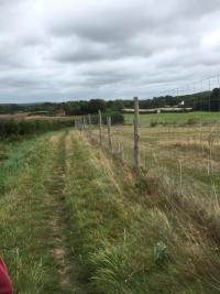
| 10.45 - you can see the railway tracks
alongside the footpath more clearly now. |
|
 |
|
..... |
|
10.54 - a change of scene. The
boardwalk is a rough bridge over a ditch.
Some way ahead I think we're
approaching the bridleway which links Wootton Farm to Bowling Green |
|
 |
|
..... |
|
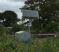
| 11.10 - This is the strange artefact
I've been wondering about since I spotted its glinting from afar. It grabbed
my attention. (Apologies to landscape survey purists.) I'm wondering... is it
a solar panel which powers some network rail data logger? Certainly not the
trains! Or - and this is an intriguing possibility - is it transmitting an
update on the train status to ET? - The next train connecting Lewes to Alpha
Centauri has been delayed by 5 minutes. |
|
 |
|
..... |
|
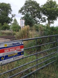
11.11 - We're now ready to cross the
tracks. In those days there were 3 or 4 places where walkers could cross the
tracks (at their own risk) along the mile of the railway running south of
Highbridge Lane upto about half way along Chiltington Lane at which point there
is a safer way to go - above the railway using
bridge
KJE1 669.
One of those level crossings (adjacent to
Kemps House) is
reserved for the use of
Network Rail.
The other foot crossings were free for all. At the time of writing this -
however - 2 of those other crossings are closed. One for repair of the broken
wooden steps leading down to the crossing, and the other was permanently closed
a few years ago for safety reasons. |
|
 |
|
..... |
|
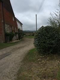
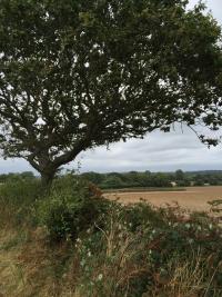
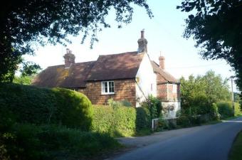
11.35 - We're now standing in the most
built up section of Chiltington Lane - which comprises a cluster of 3 houses:-
Kemps House, Burrells and Upper Burrells.
The view shown in the bullet
on the right here is from the lane looking along the side of Kemps House at the
South Downs. That's where Network Rail have their own reserved access so they
can get railway stuff from a highway to the other side of the tracks. |
|
 |
|
..... |
|
Here's another angle of Kemps House.
Reminder
- you can see better quality versions of any of these pictures and more text by
clicking on any of them. Or maybe you're getting too many words already... |
|
 |
|
..... |
|
And here's the other side of the lane.
My
neighbours might well say at this stage - how is it possible to take such
unflattering pictures of this pretty spot? Where are the flowers? Other readers
might ask - what are those signs? |
|
 |
|
..... |
|
| 12.08 - Since the last photo - we've
barely walked 100 yards up the slope from Kemps House before turning right
at Southover Cottage (much
photographed
already on these pages so need to snap again on this walk) and then we've
gone over the railway bridge (669 remember?) heading towards Spooner's Farm.
This view (on the right) is from just the other side of the railway looking in
the direction of Novington Lane and Plumpton. |
|
 |
|
..... |
|
| 12.16 - Looking back at the way we've
come. The house in the distance on the left is Kemps House. |
|
 |
|
..... |
|
| 12.16 - We've reached a sign of things
to come. |
|
 |
|
..... |
|
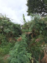
12.16 - Which confirms - if there was
any doubt among our group of well mapped Chiltington footpath veterans -
that this is indeed where we turn right and clamber up the slope.
BTW
- I always admire the ferns around here. That's why I took 2 pictures of
almost exactly the same spot. |
|
 |
|
..... |
|
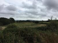
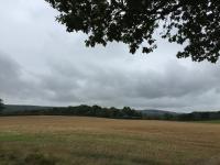
12.31 - Here are 4 views from
the top of that small fern lined slope.
The 1st is looking South
Eastwards towards Newhaven. |
|
 |
|
..... |
|
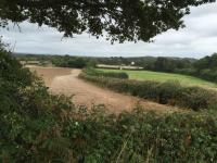
| The 2nd looks Northwards back towards the
railway line and Chiltington Lane. |
|
 |
|
..... |
|
| The 3rd is looking South Westward along the
edge of Warningore Wood. |
|
 |
|
..... |
|
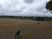
| The 4th is looking Westwards towards Wootton
Farm. The dogs have been rushing ahead us walkers at this stage and are now
veering back. Does anyone recognise their own dogs in these photos? Whether I
was trailing at the rear or rushing ahead to take photos of landscape without
too many people obscuring it - the dogs made sure no one got left behind. |
|
 |
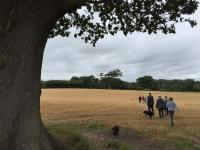
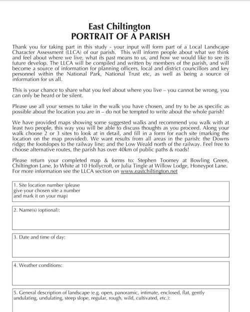
We spent spent over 20 minutes
in this small area. And in case you've been looking at the times shown above and
our slow rate of progress this is by way of an explanation.
The
purpose of this walk and the others in this series was to make a written record
at various locations of what we could see and how we felt about it which would
be fed into a future landscape assessment report.
Whenever we reached
one of the predesignated survey spots - Steve Toomey stopped the walk and handed
out a fresh set of his
survey
forms on which we would tick boxes to show what we could see and also answer
open ended questions such as these.
21 - Having assessed the
landscape visually, can you experience the landscape through other senses?
What smells, sounds and colours are around you? Try closing your eyes to
concentrate your thoughts.
22 - What do you like in this landscape?
What makes you happy being here?
I can't remember what I wrote but
I do remember commenting that someone was going to have an awfully difficult
job deciphering the scribbles.
As we had been talking with each other
along the way it was interesting for me to hear how vividly other people were
able to describe what they could see (in comparison to my bland comments about
seeing trees and grass).
Another thing I remember us talking about was
what we didn't see.We didn't see many buildings or signs of roads. This
lack of urbanisation - given our location - 15 minutes drive from Brighton, 8
minutes from Lewes and 14 minutes from Hassocks - was a remarkable thing in
itself. |
|
..... |
|
| 12.41 - This is what we could see when
we reached that tree whose canopy you can see in the top right hand corner of
the previous picture. |
|
 |
|
..... |
|
| 12.42 - One last look back (Eastward).
In the distance you can see Spooner's Farm. |
|
 |
|
..... |
|
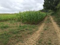
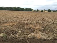
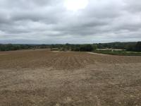
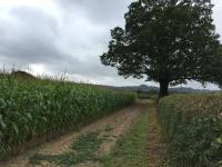
12.51 - Curving left (Southwards).
Field of corn on the left. |
|
 |
|
..... |
|
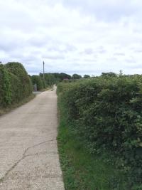
| 13.07 - We've skirted past the
Southern edge of Wootton Farm and we're heading along the track to Novington
Lane. |
|
 |
|
..... |
|
| 13.09 - We've crossed Novington Lane
where it meets the Roman Road and clambered over the stile. As we approach the
first big tree in the field - this is the view on the left (Southwards). We're
heading down a well worn path down towards the Jolly Sportsman (and Hollycroft)
which will complete the walk loop |
|
 |
|
..... |
|
| 13.09 - This is another view from the
same tree. In case you were wondering - did I somehow manage to lose the group
which had set off from Hollycroft? Maybe that story about taking pictures -
looking forwards from the front or looking backwards from the rear - to grab
the scenary instead of the group of us - was just a way of disguising that I'd
got completely lost and had been walking somewhere else entirely (maybe in
Wales) and on my own? Well here we are. And - as the forecast had warned us - it
did rain. But we finished our walk before the heavens opened. |
|
 |
|
..... |
|
the end... nearly
Were
you on those walks? Do you recognise the dogs? They were great companions on
this walk and it makes me smile seeing them in these pictures. If you can
tell me their names I will update the phot captions to give them the star
credit they deserve.
Did you post any of your photos of the East
Chiltington landscape survey walks online? - in a way that I could link to
them here from this article?
I've got more pictures too. A few
weeks after this first walk in September 2016 I went on one of the other
routes - up Novington Lane then across the fields to Blackcap. That was a
much sunnier day - everything looks so much prettier then.
Sadly in
2021 as I write this - it seems we could realistically lose it all. And in
another 5-10 years time the only part of this countryside we'll have left is
memories and photos. But don't lose heart yet. That's where the Landscape
Survey part of the walks comes in - because pictures and anecdotes like
these provide evidence for what is under threat - when we want to recruit
people to our cause to protect East Chiltington, Plumpton, St John Without and
the fields we take for granted. And these digital assets can help when you
come to write future planning letters
to oppose destructive schemes like those reported in the
Eton versus East Chiltington
chronicles on wrongthingwrongplace.com
Epilogue
In
the weeks, months and first couple of years after these landscape walks in 2016
it felt like the urgency to write up this walk in a blog here on
ChiltingtonLane.com had faded. We had won our campaign against the
caviar
farm in Chiltington Lane, Hollycroft had become designated a village
green...
But later - whenever I met up with Steve Toomey who had
organised these walks - and feeling guilty that I hadn't even written up my
little blog about it - I would ask him - Hey Steve what's happened with
the survey report?
I assumed that the handwritten forms had turned
out to be indecipherable or that the need to defend our landscape against
harmful property speculators had gone away.
A couple of years later
- Steve said that it had been decided to do a more detailed write up than just
using the raw data abstracted from the survey sheets. This job had been handed
to another neighbour of ours - Mary Parker. Mary - I knew - had been a
strong advocate for trees and hedges and water and other ecological arguments
in the caviar campaign and had written books about horse riding in the area
and children's fiction and was a keen blogger on issues related to the
countryside around here such as protecting the wildflower verges in the lanes
being mown at the wrong time of year by Highways and a quiet lanes scheme. So I
knew this would be a serious piece of work and looked forward to seeing it when
it came out.
And as another year or two went by - I wondered what had
happened. I hadn't seen any such doument on the East Chiltington Parish web
site - although there were mentions of a landscape survey in odd pages here
and there. I assumed that as things had quietened down in the planning menaces
front - maybe the thing had been dropped.
In February 2021 - while we
were all in UK Covid Lockdown #3 - we started hearing for the frist time
alarming news about a serious intention by Eton College to build a new town on
various fields around our lanes which had hitherto been regarded as do not
build anything zones. I began writing about these matters in the
Eton versus East Chiltington
chronicles on wrongthingwrongplace.com
I felt guilty at that stage
that I too had dropped the ball - and hadn't even written up my very small blog
of the first landscape survey walks . But I kept getting pulled back to
publishing snippets of news and blogs about the Eton New Town on my own web
sites - knowing that the official resident campaign - was still putting
together the name and content for its website
donturbanisethedowns.com
which only began showing its first clutch of substantive content in a site
refresh which became visible on March 29, 2021.
In April 2021 (still in
lockdown) I asked Mary Parker as she walked past my front gate what had
happened to her report?
"I finshed it years ago" she said. "And
gave it to Jenny on a CD. And then people said they wanted to change things or
add things. I'm not sure where it is now. I see samples of what was in it on the
East Chiltington web site - because you know you can recognise sentences you've
written. But I didn't put my name on the original cover because I was taught
that's not what you do in these kinds of documents - in the days when I used to
do that kind of thing. What people want in Landscape Surveys is facts and data -
not opinions."
"Do you still have a copy?" I asked.
"Yes"
- said Mary. "It's on Word. It takes up lots of space. The chapters
are big files with photos - so it will be a lot of emails."
"Who
owns the copyright?"
"I suppose I do."
"Would
you mind if I published parts or all of it on my web sites? We both know this is
the kind of raw material which would be helpful in our cause to find planning
and ecology arguments to protect us from these big developments."
"Absolutely.
Send me your new email address."
Mary sent me the book files at
the end of April 2021. I dipped into them and it's a treasure trove recording
East Chiltington. What we've got. What we'd like to protect.
One day
the whole document might appear somewhere nearby on the web. But I've got
some books to write and publish
first. |
 One
such lesson for for me was -
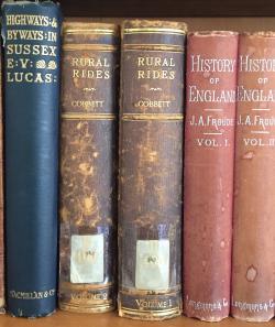
Cobbett's Rural Rides
(published 1830) which confirmed that an area of footpaths in Hampshire
where I used to live (Baughurst) was just as full of prickly gorse in the
early 1800s as it was in my walks in the early 1990s. Further afield the
Journals of the Lewis and Clark
expedition in 1804 to 1806 to map the newly purchased Louisiana territory
describes bends in rivers which later became the sites of internationally
known cities and musicals - like Chicago. (See
First Across the Continent by
Noah Brooks for an annotated guide to the expedition diaries as written from
the perspective of a mere century later.)
One
such lesson for for me was -
Cobbett's Rural Rides
(published 1830) which confirmed that an area of footpaths in Hampshire
where I used to live (Baughurst) was just as full of prickly gorse in the
early 1800s as it was in my walks in the early 1990s. Further afield the
Journals of the Lewis and Clark
expedition in 1804 to 1806 to map the newly purchased Louisiana territory
describes bends in rivers which later became the sites of internationally
known cities and musicals - like Chicago. (See
First Across the Continent by
Noah Brooks for an annotated guide to the expedition diaries as written from
the perspective of a mere century later.)
